The Great Wilderness Custom Map
Northwest Scotland
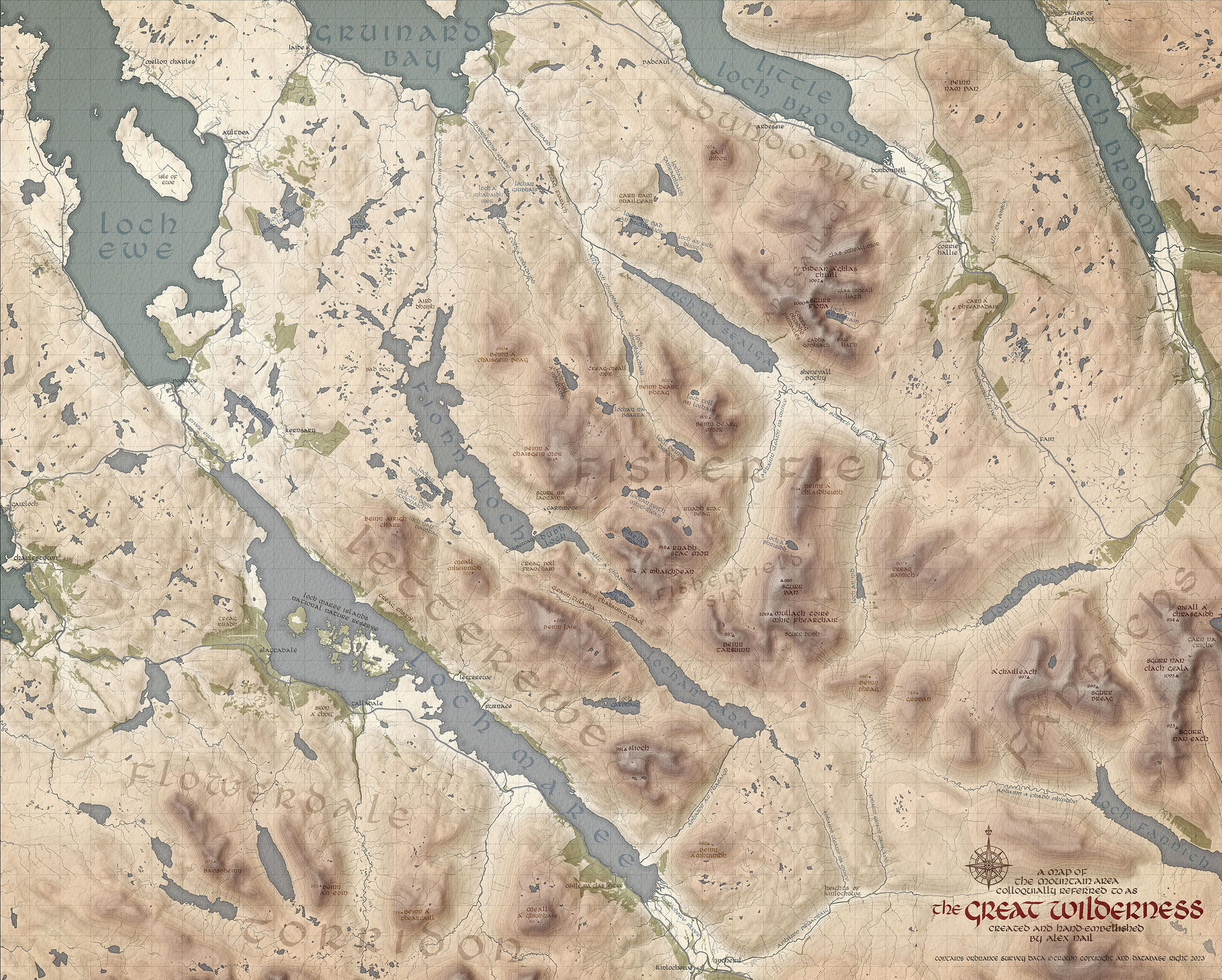
For the publication of my book "The Great Wilderness" I took on the task of creating my own map from scratch that captured many of the aesthetic qualities that appeal to me in both modern and historic maps. The basis of the map is Ordnance Survey Data which I interpretted using mapping software to give me the contours and outlines that form an accurate geographic foundation. I thinen created my own hillshades and hypsometric tints and incorporated my own textures to give the map depth. I softened many of the digital lines to make them feel more organic and hand drawn. Finally I wrote out every place name and title by hand in Uncial calligraphy using a dip pen and india ink. I then composited the calligraphy over the artwork. All in all this map represents dozens of hours of work - I spent so much time refinding and reworking it I have no real idea how long I spent! The map is available for purchase in 3 versions.
ORIGINAL FOLDED MAP (15 copies left) that was provided exclusively with book preorders - this has a matt laminate over the surface and is printed using colour offset technology offering superb resolution, but none of the lightfastness needed for long term display. It includes my hiking routes, campspots, title block and key (not shown on the above image). I did have a small number extra, and these are the last remaining.
UNFOLDED GICLEE MAP WITH ROUTES - Perfect for display, this fractionally smaller map is printed with the latest Giclee printing technology and captures every bit of detail of the original map, but with far better archival qualities. It includes my hiking routes, campspots, title block and key (not shown on the above image). Printed on Fotospeed Platinum Cotton. 490x395mm image on A2 paper
UNFOLDED GICLEE MAP NO ROUTES - As above but does not include my hiking routes, or the key, but does show the title block. This is the image you see above.